You are here
Ottoman travelogue offers glimpse into historical Southern Levant
By Saeb Rawashdeh - Jun 10,2023 - Last updated at Jun 10,2023
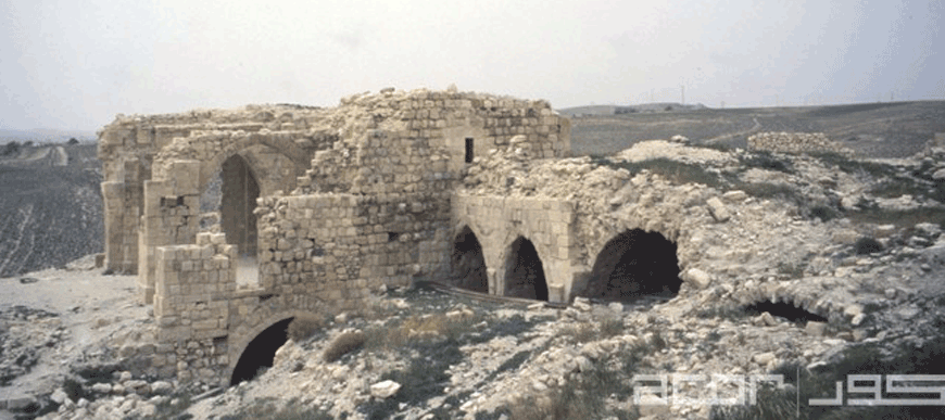
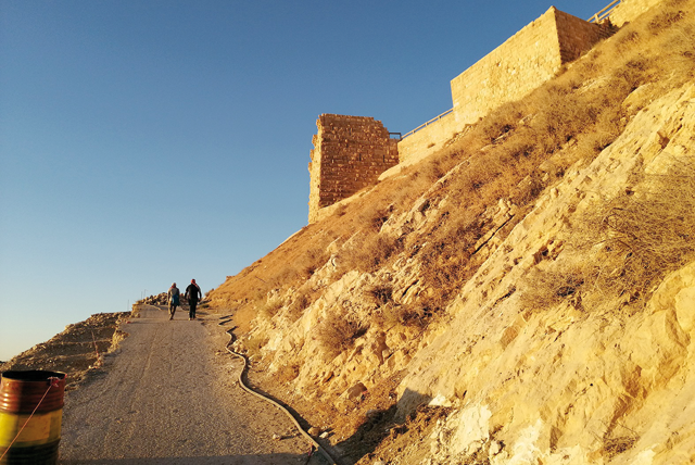
Remains of the citadel of the Shobak Castle, a fortress from Crusades (Photo courtesy of ACOR)
AMMAN — The earliest cosmographic depiction of southern Levant in the Ottoman period came from the traveller Asik Mehmed (1555-1598) in his book “Views of the Worlds”.
“Mehmed spent most of his relatively short life travelling across the Ottoman Empire,” Bonn University Professor Gul Sen noted.
Sen has been studying sites in southern Levant, including towns in Jordan, during Mamluk-Ottoman periods
For 23 years, Mehmed travelled the Ottoman Empire. Sen added that the European provinces of the Empire are depicted in greater detail than the Arabic-speaking ones, likely because Mehmed considered the latter provinces well known and were already described by Arab cosmographers and geographers.
In addition to towns and sites in the southern Levant including Jerusalem, Gaza, Nablus, Ashkelon, Ramla, Nablus, and others, Mehmed writes about Amman, Salt, Karak, Moab, Shobak and the Madaba Plains, Sen said.
Describing Moab Mehmed wrote: “It is located in the region of Karak in the Land of Syria, which is the sixth common clime. It is an ancient town.”
“Over time, it was ruined, became a village, and this village is called Rabba. The distance between Karak and Moab is shorter than half a [day’s] march and it is located in the northern side of Karak. The distance between Moab and Amman is seventy-seven kilometres,” Mehmed wrote.
Regarding Shobak, Mehmed said: “Shobak is a small town; it has a castle and lies east of Ghawr, which is located from the direction of Hijaz in the direction of Damascus. [Shobak] is situated on a high whitened hill that has a view of Ghawr. It lies in the eastern side of Ghawr. From the slope of the castle two springs emanate. One is on the right side of the castle.The castle of Shobak is built of white stones.”
Mehmed gave no data on the situation of these towns during his own time, their administrative-fiscal status or how they were structured or the population lived, noted Sen.
“This manuscript is obviously not the final version, but a draft, as indicated by the excessive notes in the margins,” Sen said.
Five southern Levant lakes are described in the first of these sub-chapters, titled “On the lakes of the Arab land”. As for the Dead Sea which he called Lake Zoara, Mehmed said: “This lake gives off a foul odour and that the Jordan River, which is the Shariah River, flows into it and disappears in it. It is possible that not a drop of the lake’s water overflows. No animal, bird, or fish exists in it. Thislake lies at the end of Ghawr from the south. It takes more than two days to circle the lake on foot.”
Mehmed represented the Ottoman intellectuals of the 16th century, Sen said, adding that these scholars were well aware of him and drew upon his work for their own compositions.
“By studying cosmography ‘Views of the Worlds’, we can gain insights into the conceptual world of a well-educated Ottoman subject of that century. They were polyglot litterateurs, at ease to compose works based on access to texts in various languages. His work is a compilation of earlier sources enhanced by his personal observations and new, original sources,” Sen highlighted.

Related Articles
AMMAN — Little attention has been paid to the early Ottoman era, but an abundant collection of documents and records could shed light on the
AMMAN — The transition between two different periods is characterised by varied and complex factors, as was the case with the transition fro
AMMAN — With the aim of identifying the urban setting outside the Shobak Castle and its rural resources between 12th and 16th centuries, an

Opinion


Dec 30, 2024

Dec 30, 2024
- Popular
- Rated
- Commented
Dec 30, 2024


Newsletter
Get top stories and blog posts emailed to you each day.