You are here
“Gem of the Black Desert”: Umm Jimal enters UNESCO family
By Sophie Constantin - Aug 05,2024 - Last updated at Aug 05,2024

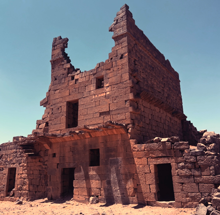
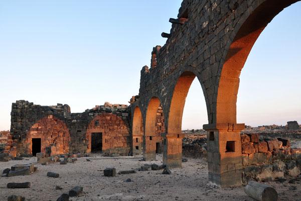
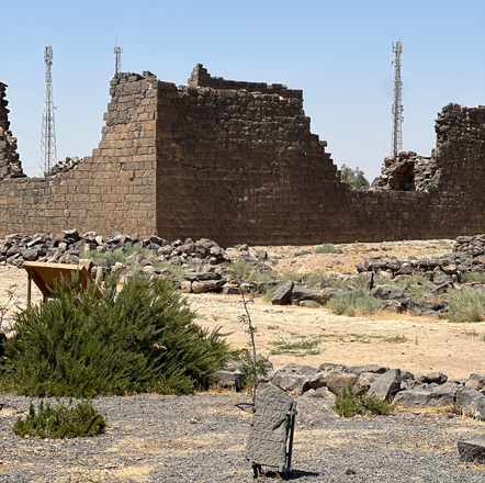
Umm Jimal’s significance lies in providing a glimpse into the everyday lives of Rome’s subjects (Photos by Sophie Constantin)
AMMAN — The United Nations Educational, Scientific and Cultural Organisation (UNESCO) has announced the inclusion of Umm Jimal to the UNESCO World Heritage List, making it the seventh site of Jordan to receive this designation, joining Petra, Qusayr Amra, Umm Rasas, Wadi Rum, the Baptism site, and As-Salt.
One prominent archaeologist left a significant legacy on Umm Jimal’s history: Bert de Vries, who created the Umm Jimal Archaeological Project, where he practiced an approach called “community archaeology” that involves local community members in the presentation and preservation of the site. Other archaeologists participated in the legacy of Umm Jimal, studying the building’s chronology or the Byzantine artefacts and churches, such as Khaled Bashaireh, Shatha Mustafa, Abdel-Qader Housan.
Situated in the semi-arid region of northern Jordan near the Syrian border, Umm Jimal lies on the edge of a basalt plain formed by prehistoric volcanic eruptions from the slopes of the Jebel Druze. This area, known as the Southern Hauran, consists of deep basalt bedrock covered by a fertile layer of reddish volcanic soil.
The site was occupied for approximately 700 years, from the 1st century AD to the 8th century, and reoccupied in the 20th century. During its initial 700 years, Umm Jimal experienced three distinct phases.
In the 1st century, Arab nomads settled under the Nabataean influence from Bostra, establishing the first village of Umm Jimal. Evidence from this era includes Greek and Nabataean inscriptions, primarily found on tombstones and altars. The villagers also began developing a sophisticated water harvesting system that persisted throughout history.
In the 2nd and 3rd centuries, Umm Jimal transitioned into a rural village that prospered due to the Nabataean sedentarisation and the region’s incorporation into the Roman Empire, becoming part of the Roman province of Arabia.
In 180 AD, the Roman authorities constructed a wall, gate, large reservoir, and the Praetorium. The village enjoyed a relatively stable and prosperous rural existence, with an estimated population of 2,000 people, as evidenced by hundreds of tombstone inscriptions in Greek and Nabataean. Those inscriptions, which many were later repurposed as building materials, reveal the Arabic and Hellenised names of several generations of villagers.
The second phase of Umm Jimal began in the 4th century AD, following the rebellion of Queen Zenobia of Palmyra. A military garrison was stationed at Umm Jimal, which was fortified as part of the Limes Arabicus, a defensive frontier system created by Emperors Diocletian and Constantine.
This military presence has enabled the civilian resettlement of the site, leading to Umm Jimal’s third phase: a prosperous rural farming and trading town of the 5th to 8th centuries. This period saw the gradual transformation from a military outpost to a civilian town, reflecting the broader cultural shift from imperial to late antique life in the East Mediterranean.
During this prosperous phase, the population likely grew to between 6,000-8,000 people, many of whom converted to Christianity. This led to the construction of 15 churches in the late 5th and 6th centuries, with Christian symbols still visible on buildings throughout the site.
After the Muslim conquest, Umm Jimal came under Umayyad control in the 7th century. Although the town’s size decreased, new construction continued, including private houses, potential conversions of some structures into mosques, as well as the remodelling of the Praetorium.
However, the Umayyad era could not prevent the decline of Umm Jimal, particularly following the AD 749 earthquake, which further diminished the population, as the community lacked the resources for reconstruction. The site’s gradual abandonment of the site continued into the Abbasid period in the 9th century, influenced by the earthquake’s aftermath, recurring pandemics, drought, and the political shift to Baghdad, marking the end of the third phase.
For over 1,100 years, the city remained largely abandoned, with buildings slowly deteriorating. Despite this, the durable basalt masonry and high-quality construction allowed for a remarkable state of preservation, with over 150 structures still standing today.
In the early 20th century, the Druze briefly resettled Umm Jimal, reconstructing some buildings. Before 1935, several buildings had their walls reconstructed so when the Druze left to move south to Azraq and Amman, they abandoned a place that appeared even more remarkably preserved.
Since 1950, a Jordanian village has developed around the now-protected antiquities of the ancient town. Until 1975, villagers relied on the ancient water collection system, but the installation of deep-well drilling shifted them to irrigated agriculture.
Unlike other Roman cities in the region, no emperor commissioned monumental buildings in Umm Jimal. However, its significance lies in providing a glimpse into the everyday lives of Rome’s subjects, contrasting with cities like Jerash, which symbolises Rome’s grandeur.

Related Articles
AMMAN — If Petra is the “rose-red” city, Um Al Jimal is a city of “all black”, constructed exclusively with dark, volcanic basalt rock.
AMMAN — Remains of ancient houses and funerary inscriptions from the Roman period have been found in Dafyana, a site located in southern Haw
Umm Jimal/Mafraq — Minister of Tourism Makram Queisi expressed his enthusiasm about the economic benefits Jordan stands to gain following th


