You are here
Investigating Karak plateau’s strategic forts
By Saeb Rawashdeh - Aug 07,2024 - Last updated at Aug 07,2024
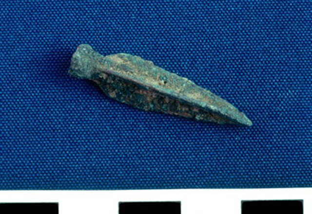
Trilobate point side view measured in centimetres (Photo courtesy of KRP)
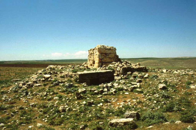
AMMAN — Gerald L. Mattingly, Johnson Bible College, and James H. Pace, Elon University, report: The Karak Resources Project (KRP) conducted its fifth season of fieldwork in 2009.
The KRP is a multidisciplinary investigation of the Karak plateau that includes excavation of the fort of Khirbat Mudaybi, regional archaeological survey to locate new sites and monitor changes to sites documented by earlier projects and regional scientific studies on a variety of cultural and environmental topics.
The KRP has focused on two pivotal questions: how have occupants of Karak plateau survived with available resources on the desert fringe, and How have these strategies changed over time.
“The excavation of Khirbat Mudaybi, a strategically located fort in the south-eastern corner of ancient Moab, serves as an excellent case study in resource utilisation.
It was originally built and occupied towards the end of Iron II and used sporadically in the Roman, Late Byzantine–Early Islamic, Middle Islamic and Late Islamic periods,” noted James Pace from Elon University, adding that on the east, Khirbat Mudaybi overlooks a geological fault known as Fajj Usaykir, which extends generally northwest from the eastern desert towards the ancient town of Karak.
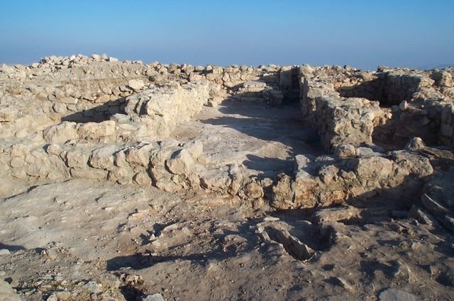
The Fajj served as a natural corridor connecting the desert and fertile interior of the plateau. From its strategic location, occupants of this fort monitored both hostile and commercial traffic entering and leaving the plateau. In addition to providing new information about the settlement history of the Karak region, excavation has recovered artefacts and eco-facts that reflect specific domestic, industrial and commercial activities, Pace said, noting that the fort (with a massive four-chamber gate, walls, and interval and corner towers) illustrates how the Iron II builders developed this hilltop into a strategic military and commercial position, which was remodelled in Byzantine and Islamic times as a way station for caravans.
“During the 2009 field season, excavation in 11 squares in three archaeological fields [fields A, B, and D] added significantly to what KRP learned about the Iron II fort in earlier seasons. In field A, excavations along the northern perimeter wall confirmed the presence of a casemate system of fortifications,” Pace explained, adding that the research team also learned more about modifications made to the fort’s interior during the Late Byzantine–Early Islamic period.
The north side of this gate complex either was never finished or had been quarried to build later structures and from a secondary context in the gate area, KRP recovered a small fragment of a limestone relief, which might depict figures in a procession.
The team uncovered a doorway and staircase that gave access to a tower in the fort’s north-western corner; this work helps fill in details concerning the site’s overall layout, the scholar said, adding that the small number of objects and pottery recovered in 2009, as well as certain architectural indications, point to a relatively short period of occupation toward the end of the Iron Age.
“Nevertheless, the stratigraphic excavation of Mudaybi provides an opportunity to define the pottery styles from this late Iron II site, and it offers a window on ceramic traditions from the later Byzantine and Islamic periods. The collection and ongoing analysis of faunal and archaeo-botanical materials will provide insights into the ancient economy and environment,” Pace outlined.
KRP has now added more than 150 sites to the Miller Pinkerton list of 443 sites and the recovery of information about all of the region’s sites remains a high priority, since the Karak plateau —like much of Jordan —is experiencing rapid population growth and development.
Furthermore, members of the survey located and documented ancient roads and other ancient features in the vicinity of Khirbat Mudaybi.
“They focused their attention on the relation between roads and water management [e.g., wells, cisterns, channels]. To date, regional scientific studies have focused on Bedouin and village economies, water resources, soil science and geology,” Pace said, adding that it was a multiseason effort that will produce a useful publication on soils and topography, including drainage patterns and line-of-sight studies.
Related Articles
AMMAN — The French nobleman, archaeologist and orientalist Louis Felicien de Saulcy(1807-1880) left the first detailed account about Khirbat
AMMAN — Khirbat as-Sar is 972m above sea level on the western end of the plateau, commanding access to Rabbat Ammon/Philadelphia (Amman of t
AMMAN — Khirbat Ataruz is located 24 kilometres south of the town of Madaba, 10 kilometres west of the village Libb and 3 kilometres east of

Opinion
Feb 19, 2025
Feb 18, 2025
Feb 18, 2025
- Popular
- Rated
- Commented
Feb 18, 2025
Feb 18, 2025
Newsletter
Get top stories and blog posts emailed to you each day.


