You are here
Dutch-Jordanian team studies 2,000-Year-Old qanat network near Udhruh
By Saeb Rawashdeh - Nov 17,2024 - Last updated at Nov 17,2024

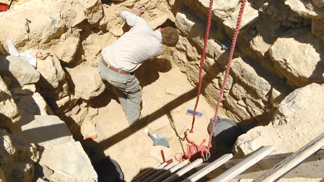
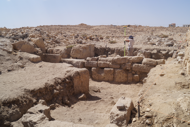
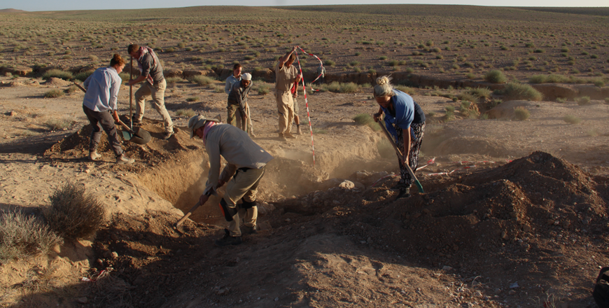
The team of Dutch and Jordanian scholars has been studying ancient water harvesting in a dry area of the Petra hinterland (Photo courtesy of Udhruh Archaeological Project)
AMMAN — Udhruh, some 15 kilometres east of Petra and known from the Nabataean, Roman and Byzantine times, is a place where Jordanian and Dutch experts study ancient water harvesting and subterranean structures used to collect and preserve water in a very arid area of the Petra hinterland.
“For the subsurface part, three lines of vertical qanat shafts (totalling more than 200 individual shafts) were dug and hacked out of the limestone bedrock, 1.1–3.9 kilometres south-east of the fortress of Udhruh,” said the professor Mark Driessen from Leiden University.
Driessen added that these shafts are currently filled in, and recognisable by circular mounds or hollows, "probably created during the construction and maintenance of the shafts, and later filled in with blown- or filled-in debris."
"We have already counted 243 of these circular mounds, positioned at regular intervals of about 25–30 metres apart. There must have been more though, as some parts of the lines lack such mounds and some shafts are losing their surface visibility as a result of erosion and modern cultivation," the professor said.
"At the western side – near Tell Abara – the qanat tapped into three or four ‘mother wells’ which are probably fed by groundwater from elevated aquifers," Driessen elaborated, adding that a modern water station is situated to the west of Tell Abara and close to the mother well in the southernmost line of shafts.
The Dutch team noticed over several campaigns that a small but continuous flow of pulsating water was coming out of a surface pipe near this station, which was probably drilled into the subterranean water level.
Therefore, they assumed that the aquifers must still contain water.
“The three lines seem to merge near the modern Udhruh – Maan road approximately 2.8 km south-east of Udhruh,” said professor Fawzi Abudanah from Al Hussein Bin Talal University in Maan, adding that this intersection is uncertain, however, because of the observable distortions in this area, and further east two parallel lines of shafts are seen heading towards the Wadi Fiqay.
Along with construction and maintenance purposes, the shafts play an important role in ventilation of the qanat: The horizontal underground tunnels of the Udhruh qanat have not been investigated yet, as the vertical shafts are filled in.
Shafts in that area are still fully or partly opened in the area.
"A start has been made on the archaeological excavation of one vertical shaft, which was stopped unfortunately after four metres because we reached the maximum depth with the ladder we had available," Driessen explained.
He added that it was already clear that the more or less square shaft (about 2 × 2m) was cut through the Muwaqqar Chalk Marl rock formation, with evenly distributed man-made holes in the opposite walls, which were probably used to hold bars for a ladder construction.
For the safer exploration, a large tripod and military rope hoists is used to further excavate this qanat shaft.
Soil samples will be taken to date the period during which the qanats went out of operation, and also for micro-morphological research in order to find out if the backfilling started through natural processes or anthropogenic activities, Abudanah elaborated.
He pointed out that reaching the bottom of this shaft will also "allow us to access and gain knowledge about the horizontal tunnel and channel construction, hopefully with datable material culture and mortar samples."
"The aim is eventually to excavate at least one ‘mother well’ shaft and two other additional shafts to obtain data, especially on the hydrological capacities of the channels," Abudanah underlined.
Abdudanah continued: "The subsurface parts of qanats transport water from a mother well to a surface outlet. After travelling 3.1–4.5km through underground conduits, the water probably reaches a surface outlet. An erosion gully in the alluvial deposits of the Wadi Fiqay unearthed two parallel surface channels of different construction only 200 metres from the most north-eastern qanat shaft."
“An outlet point can therefore be expected somewhere in these environs. The surface parts of the water scheme in this wadi are covered with thick alluvial deposits in some places, while at other spots they stand above the current ground level,” Driessen explained.
He noted that the surface water conduits – with total lengths of 1.9 and 2.6km – end at two large reservoirs connected to agricultural field systems.
"The maximum capacity of this reservoir [with an inside surface of 988 square metres] was about 2.7 million litres of water," Diessen underscored.
Related Articles
AMMAN – The area around the Nabataean and later Roman site Udhruh is covered with a network of smaller sites and watchtowers.
AMMAN — Scholars Fawzi Abudanah and Mark Driessen distinguished three ancient agro-hydrological systems in the Udhruh region, some 15 kilome
MAAN — Udhruh is a site located some 15 kilometres east of Petra and represents an open laboratory in water management.


