AMMAN – The area around the Nabataean and later Roman site Udhruh is covered with a network of smaller sites and watchtowers. The Dutch team studied the area and connectivity of the fortress of Udhruh with several hilltop sites in the region. On eight of these hilltops, structures were retrieved, which were probably part of a signalling system.
These hilltops have elevated and strategic locations with wide views over the region, with remnants of watchtower-like structures on top and they are connected to each other, Udhruh and Petra through sight, noted the professor Fawzi Abudanah who initiated Jordanian-Dutch collaboration a few decades ago.
"The first one is Jabal Tahkim, which lies 1600 m north of the fortress of Udhruh and is a prominent hill in the area. From Jabal Tahkim, elevated approximately 60 metres above the Udhruh fortress, there is an excellent and wide view over the landscape. On clear days the Nabataean-Roman stronghold of Khirbet Qirana – 39 km to the south – and the hilltops near Dana – 39 km to the north – are within visual range," said Abudanah, who teaches at Hussein Bin Talal University in Maan, adding that Jabal Tahkim lies within the network of visibility of almost all the other examined hilltop sites and the irrigated field system in Wadi Fiqay.
The view to the Udhruh fortress is, apart from the south-western corner tower, blocked by the western part of Tell Jraideh. This corner tower can be seen clearly from the L-shaped structure on top of Jabal Tahkim, said the scholar Marc Driessen, adding that the team found the pottery from the Roman era, although during earlier research also Nabataean, late Byzantine, early Islamic and Ottoman pottery was retrieved.
"The location of and the visibility to and from the site in connection with the relative massive outer walls points to a military or defensive use as a fort let or signalling tower," Driessen said, adding that the pottery evidence indicates that it had a Roman phase, but the odd shape of this 0.08 ha structure seems anomalous for the layout of a Roman fortlet or watchtower. Moreover, the vast amount of Nabataean pottery found here by Nelson Glueck might also point to an initial Nabataean construction.
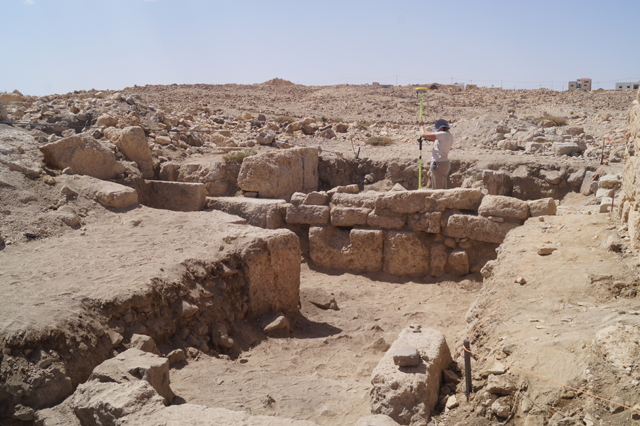
A crescent shaped hill 700 metres northeast of Udhruh is called Tell Jraideh and the eastern part of the hill a quarry, several caves and two built structures were located. "The caves seem to have been used throughout a long period, as is the case with many caves in the research area," Driessen said, noting that the best-preserved of the two built structures measures 40x47 metres and is located at the southeast side of the hill.
The structure is built of quarried and finished coquina and limestone blocks, which resemble the ones used for the fortress of Udhruh, the Dutch expert said, adding that the ceramic evidence corresponds with the most prominent periods of use of the fortress and later town of Udhruh.
"The site has an undisturbed view over the fortress of Udhruh, as is the case with Tell Udhruh and Abu Raa. Tell Jraideh had only a local function in connection with the fortress – if it was even used in the signalling system – because of the limited visibility to the other watchtowers in the region," Driessen stressed, noting that Tell Udhruh overlooks the complete fortress of Udhru hand has, like Jabal Tahkim and Abu Raa, visual control over the water systems towards and irrigated fields in Wadi Fiqay.
Pottery dating from the Early Bronze Age, Edomite, Nabataean, Roman and Byzantine periods, were found at the site. Abu Raa hosted a smaller Roman camp and the site points to a use in Nabataean, Roman and Byzantine periods.
"In an almost straight line south of Udhruh, two more prominent hills in the landscape were investigated. The first –5600 m south of Udhruh – is called Tell Saia and Tell Qusaib, which lies 1700 metres further to the south, at a distance of 7.3 km from the fortress of Udhruh, Abudanah said, adding that from Tell Qusaib with a extensive and spectacular view over the region and many other hilltops, the south-western tower of the Udhruh fortress could be seen.
The connectivity to Petra has similarly both a military and a civilian aspect: Formal military communication between Petra and the Udhruh fortress may consist of security warnings and summons for mobilisation, but informal exchange beyond direct military threats may relate to the connected fields and water systems which, for instance, require the deployment or assistance of troops here, professors underlined.
