You are here
Ancient Nabataeans built dams, terraces to mitigate flooding in Petra — Jordanian researcher
By Saeb Rawashdeh - Mar 07,2019 - Last updated at Mar 07,2019
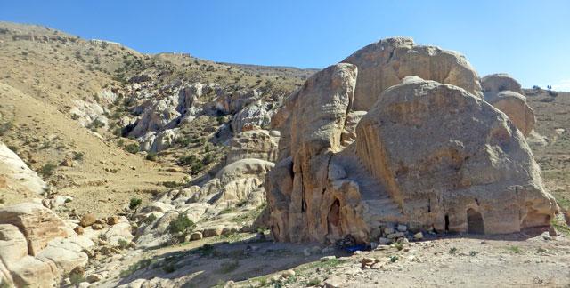
In this undated photo, a structure used by the ancient Nabataeans to harvest rainwater for agriculture can be seen (Photo courtesy of Catreena Hamarneh)
AMMAN — A Jordanian scholar on Wednesday gave a lecture outlining the ancient Nabataeans’ water-harvesting prowess, exemplified by the Qantara-Hremeyyeh catchment area located 3km southwest of Wadi Musa.
The Wadi Musa-Tayiba Rajef Highway defines the upper boundary, while the Siq gorge formulates the lower segment of the catchment, Catreena Hamarneh said at a lecture titled, “Petra Landscape between harnessing and co-existence: Quntara-Hremeyyeh catchment area as a case study” and held at the German Protestant Institute of Archaeology.
“The wadi flows from the mountains all the way down to the Treasury at the entrance of Petra causing torrential flooding,” elaborated Hamarneh, a University of Jordan graduate.
The overall catchment area is small, less than 5sq.m. but it contains a number of geological formations, Hamarneh noted, saying that the Nabataeans’ water management works reflected the importance of the area.
“Their intervention within the catchment area started around the 1st century BC and intensified during the late Nabataean-Roman period [50 BC – 112 AD], resulting in rich archaeological elements found within the site,” Hamarneh underlined.
Despite the fact that several travellers and scholars have studied the site, she elaborated, their work focused on individual aspects or elements such as inscriptions or tomb facades.
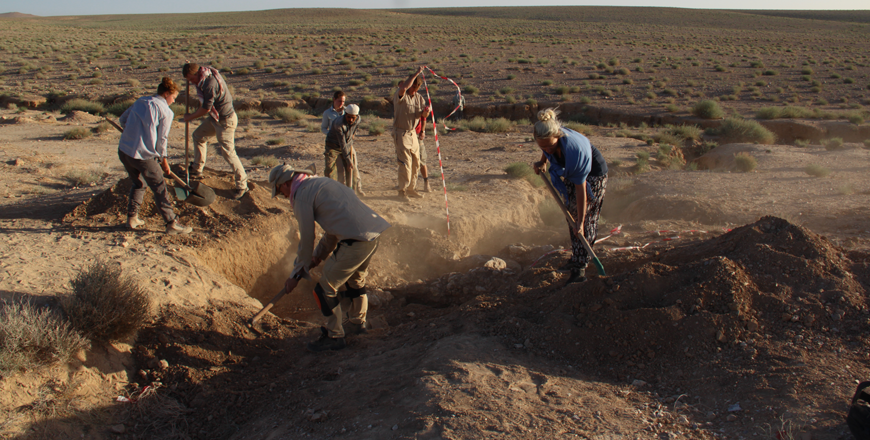
A full survey of the catchment area, conducted by the German Jordanian University and funded by the American Ambassadors Fund for Cultural Preservation, collected soil samples and mortar for analysis, “which helped reveal much about Nabataean surface management and intervention policies”, the scholar underlined.
Nabataean management varied from hydrological installations to religious complexes, funerary carved facades to defensive installations, and from erosion control to agricultural installations, Hamarneh said.
The study was also first attempt to present the catchment as a whole entity from the perspective of the Nabataeans; according to the researcher, who added that the Nabataeans understood the significance of the catchment area, as their work at the site indicates.
For example, Nabataeans directly intervened with the area’s topography: “First, the narrow wadies were chiselled to widen their path, thus slowing the water, which would minimise its strength, along with a set of check dams which prevented the flooding of the Al Khazneh [The Treasury] Plaza, and helped collect water for further use for agro-pastoral activity. The second was the construction of a set of contour terraces at the upper catchment, which not only minimised sheet flow and collected sediment, but also created a built up that minimised the high relief,” she outlined.
However, the original plans might have been different, she continued, as the survey showed that the original intent was to construct an aqueduct through the Hremeyyeh catchment.
“To protect the line, several terraces where constructed to prevent its further damage by torrents,” Hamarneh explained, adding that in “the heydays of the catchment area, which were in the 1st century BC to 1st century AD, a small shrine and several divine representations appeared”.
Furthermore, water-harvesting systems and agricultural installations such as wadi terraces, a press and silos were constructed, which were managed by the inhabitants of the Ayn Braq settlement, Hamarneh underlined, noting that the analytical study has shown that the construction of the terraces changed not only the area’s surface morphology but also its soil quality, making it “more suitable for cultivation”.
Terracing also helped keep the soil moist, a fundamental need in an arid environment such as Petra, she underscored.
With the annexation of Arabia by the Roman emperor Trajan in 106 AD and the ban of private cults, the site of Wadi Hremeyyeh transformed from a cultic agrarian location to a domestic site which was shortly abandoned afterwards, she said.
“It was only around the Ottoman period that the site was revitalised as a pastoral area inhabited seasonally by local tribes as evident from graffiti left in the caves,” Hamarneh concluded.

Related Articles

AMMAN — The “Restoration of the Ancient Nabataean Flood Control System in Wadi Madras at Petra” project has won the Arab Forum for Cultural
AMMAN — Scholars Fawzi Abudanah and Mark Driessen distinguished three ancient agro-hydrological systems in the Udhruh region, some 15 kilome
AMMAN — Despite the low rainfall in Petra, the Nabataeans managed to create “a very sophisticated system” to capture and use this water to g

Opinion


Apr 16, 2025


- Popular
- Rated
- Commented
Apr 16, 2025


Newsletter
Get top stories and blog posts emailed to you each day.