You are here
Iqlim Fahl: Strategic, agricultural hub in Mamluk-era Jordan
By Saeb Rawashdeh - Mar 18,2025 - Last updated at Mar 18,2025
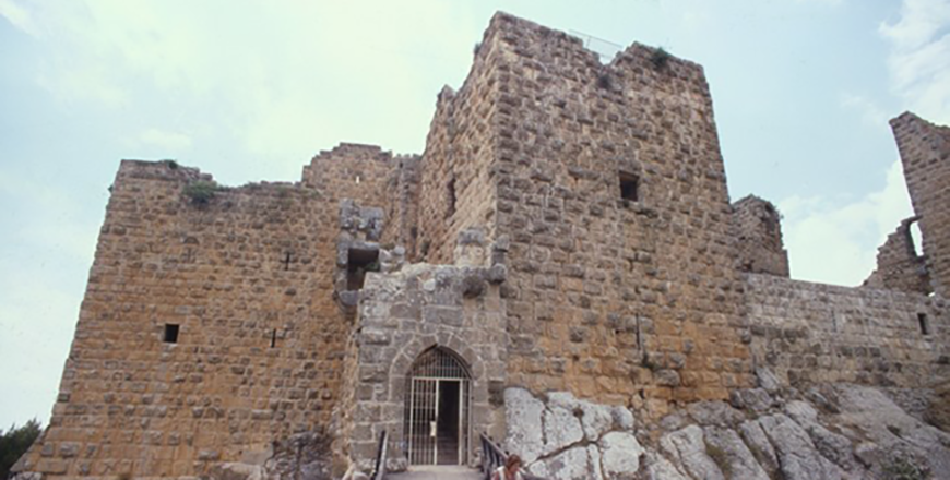
Ajloun Castle was built in 12th century and is situated in the north-western part of Jordan (Photo courtesy of ACOR)
AMMAN — The Iqlim Fahl was one of the many districts that constituted the extensive Mamlakat Dimashq in Bilad Al Sham during the Mamluk period (1250/1263 – 1517 CE).
The great size of this Mamlakah (“kingdom”) reflected the enduring importance of Damascus in middle Islamic times, and in Jordan encompassed all of the territory north of the dominant Wadi Mujib, noted an Australian scholar.
Under Mamluk administration, northern Jordan was subdivided into five principal regions as recorded in the geographical work of Dimashqi from 1327 and the detailed encyclopaedic reference compiled by the Egyptian polymath Al Qalqashandi (1346- 1418). These were in essence:
1) The Balqâ’ region, which included the towns of Salt, ‘Amman and Zarqa’, all fortified under the Ayyubids; and also Hisbân, a town of sufficient importance to be the capital of the Balqa for a term;
2) The Jabal ‘Awf region with the fortified town of ‘Ajlun, the castle of which was built between 1188 and 1192, later extended in 1214/15;
3) The Sawad, and in particular the districts (iqlim) of Bayt Ras and Fahl;
4) The upper Ghawr with its principal town of Qusayr, modern North Shunah, seemingly equipped with a small fort;
5) The middle Ghawr around the town of ‘Amata (modern Abu ‘Ubaydah), the burial place of the conqueror of Bilad Al Sham and a Companion of the Prophet," Professor Alan Walmsley from the Macquarie University in Australia elaborated.
Accordingly, the southern boundary of the Mamlakat Dimashq, where it adjoined the Mamlakat Karak, ran along, or just north of, the Wadî Mujib/Wadi Wala catchment, for Ziza (modern Jiza) seemingly functioned as a forward station for the Balqa and was equipped with a small but solid fort.
“The boundary continued south along the west side of the Dead Sea and the Wadi
Arabah as the lower Ghawr belonged to Karak,” Walmsley stressed, adding that this administrative division, reflecting deeper socio-cultural differences, was not unusual for Jordan.
“The Wadi Mujib formed the divide between the Byzantine provinces of Arabia and Palaestina Tertia and re-surfaced in the Fatimid period as the boundary between Al Maqdisi’s districts of Filasin and Al Sharah," Walmsley noted.
At the centre of the Iqlim Fahl, and providing its name, was the settlement of Fahl, today officially known as Tabaqat Fahl (ancient Pella).
Fahl is an ancient site, continuously occupied since the Neolithic period (from c. 6000 BC), with particularly extensive preserved remains from the Bronze and Iron Ages (roughly 2ndand 1stmillennium BC), the Hellenistic period (3rd -1stfirst centuries BC) the Byzantine–early Islamic periods (5th -9thcenturies CE), and later Islamic periods notably Ayyûbid and Mamlûk.
The middle Islamic name of Fahl, originally Fihl in Umayyad and ‘Abbâsid times (but without meaning in Arabic, as noted by Al Ya‘qûbi, hence the change), stems from the ancient Semitic name of Pahil, and the continuity of this name over a minimum of four thousand years is indicative of the site’s long settlement history.
"Its historical significance was partly strategic, partly resource-based. Fahl straddled well-established communication routes that linked the Jordanian highlands with the Jordan Valley, especially Baysân, and from there roads continued eastwards along the easily transversed Marj ibn ‘Amr to ports on the Mediterranean Sea," Walmsley elaborated.
The professor added that Fahl served, then, as a traditional “gateway” site between the coastal routes of Palestine and the highland roads that crossed Jordan.
It also had — and still has — the decided advantage of excellent natural resources, especially productive agricultural lands including the rich tabaqah and a prolific spring, which at c. 1180 cubic m/hr is the second most powerful in the Jordan Valley, according to the professor.
Although in the Mamluk period the main lateral road from east to west passed north of Fahl between Baysan and Al Qusayr over the Jisr Al Mujami,Fahl regained a measure of its former importance by benefitting from an accelerated pace of social and economic reconstruction under the Ayyubids and early Mamluks.
"A hot climate, good water supplies, a replenished labour force, a ready market in Cairo, the growth of Mediterranean trade, and large landholdings by the sultan or his emirs encouraged the cultivation of commercial crops in the valley notably sugar, dates and bananas," Walmsley underlined.
The professor added that Fahl still retained a strategic importance, as it lay between the major settlements of Al Qusayr in the upper Jordan Valley and Ajlun, positioned high in the Jabal Awf region to the south-east.


Related Articles
AMMAN — Southern Levant was in the Egyptian orbit around 884AD and it continued to be during the Middle Islamic Period (1000AD-1500AD).

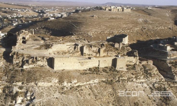
AMMAN — In the Mamluk period, some of the most politically dangerous persons went to Karak Castle, said an American scholar.Karak Castle, a
AMMAN — During the Mamluk period, the area which is now modern-day Jordan was administratively divided between the Provinces of Karak and Da

Opinion
Apr 19, 2025
Apr 19, 2025

Apr 19, 2025
Apr 19, 2025
- Popular
- Rated
- Commented
Apr 19, 2025
Apr 19, 2025
Apr 19, 2025
Apr 19, 2025


Newsletter
Get top stories and blog posts emailed to you each day.