AMMAN — European interest in cartography of the Levant dates back to at least the 16th century, according to a Swiss researcher.
“The first map which I detected as showing the exact location of Petra, including an abbreviated view of the city surrounded by mountains, was the one in Palazzo Colonna in Rome,” noted Ulrich Bellwald in a recent e-mail interview with The Jordan Times, adding that the map was drawn by Bartolomeo Bonomi in 1572.
The map is called “Portolano del Mediterraneo” (“Mediterranean ports”) and the commissioner of the work was Marcantonio Colonna (1534-84), an Italian aristocrat serving the Spanish Crown, Bellwald said.
As Bartolomeo Bonomi was an illustrator and engraver, rather than a surveyor or an engineer, the scholar said he wondered which models Bonomi would have used for creating the map.
Colonna was an admiral in the battle of Lepanto, a naval engagement that took place in 1571, in which a coalition of European Catholic states arranged by Pope Pius V inflicted a major defeat on the fleet of the Ottoman Empire. Thus, Bellwald thinks these models “would most probably have come from the Ottoman side”.
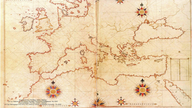
The scholar referenced “Kitab-i-Bahriye” (The Book of Navigation) by Hadji Ahmed Muhiddin Piri, saying that its first edition was printed in 1521, and its second shortly after, in 1525.
After finding the original cartographic drawings in an archive in Istanbul, he said he was sure that Bonomi used Piri’s maps as models for his own Portolano at the Palazzo Colonna, not only copying the size and shape of the maps, but also the surveying lines, locations and names of the port and other cities.
Piri’s work did not only show the most important ports, but also depicted cities in the hinterland, such as Petra and Damascus, Bellwald said, adding that it must have been rather easy for either Bonomi or Colonna to get a copy of Piri’s book as “there were numerous copies in the great libraries all over Europe”.
When the Swiss orientalist Johann Ludwig Burckhardt famously rediscovered Petra in 1812, the name and location of the ancient Nabatean city was already known to a large group of well-educated people in Europe, he stressed.
The third edition of Piri’s book, which gained even more popularity, included newer maps from Italian geographers Battista Agnese and Jacopo Gastaldi, and Dutch geographer Abraham Ortelius, Bellwald said, adding that this shows that there was a well-organised cooperation between Ottoman and Western scholars.
The scholar also said that the findings infer that “the rediscovery of Petra by Burckhardt in 1812 was not purely occasional, but he went to the area of Wadi Musa with the knowledge that Petra must be located there”.
