AMMAN – Climatic changes directly affected resource availability, which in turn necessitated a change in the land use strategies, said the American archaeologist Geoffrey Clark from Arizona State University, noting that the dichotomised model is conceptually into radiating and circulating strategies.
"For the early and middle Epipaleolithic, the model suggests foragers practiced a circulating strategy of land use. With a circulating strategy, extractive/special activity sites are apt to be small, perhaps archaeologically invisible loci, while base camps, which vary in the length of occupation, are not expected to be formally structured in terms of their use of space," said the professor.
With a radiating strategy, base camps are organised logistically and may be highly visible due to extended occupations and the accumulation of midden deposits.
They may contain greater intrasite patterning with regard to structures, features and disposal areas. Extractive sites are expected to be more numerous, although still potentially invisible archaeologically, because of the limited range of activities occurring there, Clark explained, adding that Henry's model of forager land-use is based upon the seasonal movement of foragers between upland and lowland settings.
"This model is used to characterise land-use strategies over much of the later Pleistocene and Holocene, but is especially relevant to the Epipaleolithic, where it is linked to a large body of archaeological data."
"Henry suggests that larger winter camps will be found in lowland settings whereas the smaller summer camps are situated in upland regions," Clark said, noting that variations on the upland/lowland pattern of settlement have also been applied to areas of the western Levant.
Although these models are derived from regional databases, their applicability to other areas, especially the inland regions of northern and central Jordan, remains to be tested.
"In particular, we are interested in the inland regions characterised by lakes or oases. During the late Pleistocene, inland lakes were present in the Jafr Basin, the Azraq Basin, the northern Jordan Valley, and the eastern Wadi Hasa."
These lake beds are presently located in arid, steppe/desert environments, yet, the archaeological record from these regions suggests that these were areas of intensive and repeated settlement in the prehistoric past," Clark underlined, noting that the Wadi Hasa is a major E-w drainage system that empties into the Jordanian Rift Valley.
The Hasa appears to have been an important resource base and corridor for population movement throughout the prehistoric and historical periods. Archaeological survey of the drainage over the last 15 years has yielded in excess of 1600 sites spanning the Lower Palaeolithic through the Ottoman periods, Clark said, adding that Tor Tareeq, is an early to middle Epipaleolithic site along the south bank of the Wadi Al Hasa.
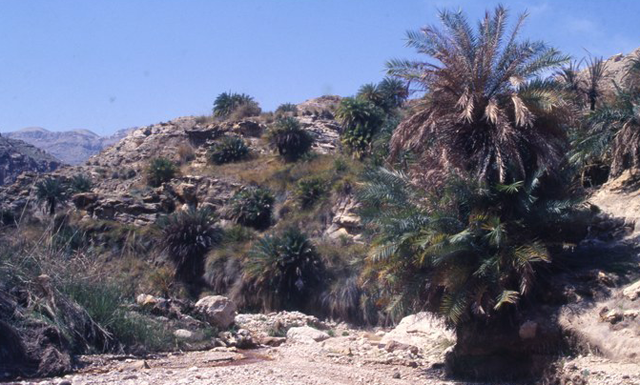
"The site covers about 812 sq m along a slope below a collapsed rock shelter and fossil spring deposit. Initial assessments suggest a series of camps moving up and down the slope following fluctuations of the level of the. The site is situated along a minor tributary [the Wadi er-Ruwaq] on the south bank of the Wadi Hasa," the professor explained, adding that the area today is characterised by Irano-Turanian vegetation and receives between 100 and 200 mm of rainfall annually.
During the late Pleistocene, the site was situated on the shore of a mildly alkaline lake. Marl deposits, remnants of the Pleistocene lake, are preserved today at an elevation of approximately 815 m.
"These probably represent the most recent high water levels of the lake. The high stands seem to have occurred sometime between 25,000 and 20,000 b.p. By the time of the early Epipaleolithic occupation (ca. 17,000- 15,000 years ago), the lake was characterised by paludal conditions indicating a low energy depositional environment."
Fieldwork was initiated in 1984 under the aegis of the Wadi Hasa Paleolithic Project [WHPP] with the aim of recording information on the paleo-environmental, geo-morphological, and cultural history of the eastern Hasa region," Clark underlined.
At Tor Tareeq this included an intensive surface collection of 95 per cent of the site followed by the excavation of a 44 m long step trench down the middle of the site.
"The high density of lithic material in distinct strata indicates that the site was occupied repeatedly and/or intensively over time. The major part of the occupation appears to represent an early phase of the Levantine Epipaleolithic, based on techno-typological indicators [narrow backed bladelets and microburins] and radiocarbon dates that range between 16,000 and 15,000 years ago," Clark concluded.
