 Share Story


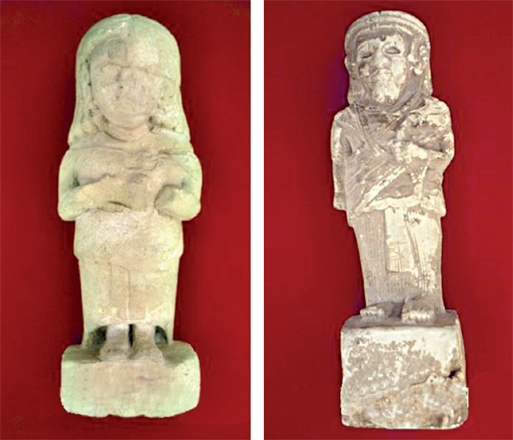
AMMAN — Amman and its surroundings were a main centre of the Ammonite Kingdom and some of their structures can be found on the Amman Citadel, in Abdoun and Bayader Wadi Sir, on the western outskirt of the capital.
The Iron Age was characterised by the power struggle between Egyptian dynasties and Mesopotamian kingdoms who fought over the control of modern-day Jordan. Kings Highway was one of the main arteries of the trade and during invasion of Pharaoh Shoshenq (945BC-924BC) his troops occupied southern Levant where sources mention the state of Ammon. On the other hand, Assyrian ruler Shalmaneser III (891BC – 824BC) was also active in the area and kept Ammonite state as the vassal of his kingdom. During the 8th century BC, Assyrians invaded the area and destroyed many of them on the costal and northern part of Galilee in 722BC.
“The evidence for the Ammonites’ role in the Neo-Assyrian Empire is reasonably clear because of the Neo-Assyrian texts that mention them,” noted Associate Director of American Centre of Research Jehad Haron in his work dedicated to the history of Ammonites and their relations with important political centres of that time.
The Ammonites became vassals around 734BC and faithfully paid their tribute thereafter, Haron continued, adding that they also contributed building supplies for Esarhaddon and troops for Assurbanipal’s army and had to accept a watchful eye on their handling of trade.
An Assyrian official was placed in or near the Amman Plateau to keep watch over Ammonite activities, like a kind of a viceroy.
Furthermore, the Babylonians ravished the east part and they destroyed many cities, including Jerusalem in 586BC.
The policy of a vassal’s paying tribute constituted the international rules at that time, for the Ammonites followed it and that enabled them to live and expand under the protection of this policy.
“They saved their land even under the Babylonian invasion through paying tribute such as wine jars in some cases; moreover, their policy saved their country until the 4th century BC,” Haron underlined, adding that the Ammonites appear to have been involved in plots against Babylon and later still against the Babylonian appointed governor in Judah.
Ammonate borders were not strictly defined in the modern sense and that was the case with other state entities in the antiquity. Therefore, scholars still debate how to define and draw borders in the Iron Age. Haron prefers the term frontier more than border and he compares the chain of the Ammonite fortifications and watchtowers with what the Roman established hundreds of years ago as Limes Arabicus.
Haron called it Limes Ammonites trying to reconstruct the more precise map of Ammonite frontiers and sites.
“The definition of ‘border’ varies: For some it means a ‘line separating two political or geographical areas’ or ‘the edge or boundary of something or the part near it’ or something that defines ‘geographic boundaries of political entities or legal jurisdictions’,” Haron underlined, adding that the biblical accounts give us different locations for Ammonite borders.
According to the biblical accounts, the Ammonite states stretched from Wadi Mujib on the south to Zarqa River on the north.
“The new discoveries in the eastern part of Amman provide a persuasive clue that the desert was not the eastern border of the Ammonites due to the intensive presence of the Ammonite sites,” Haron underscored.